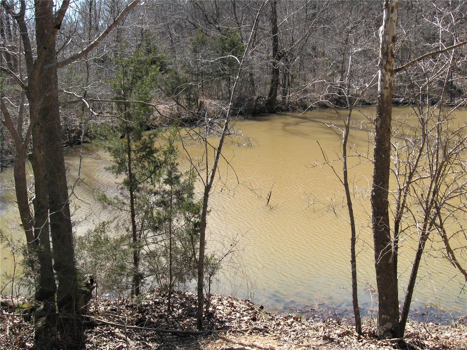
17650 Superior Road


Description
- Listed by Michael Drury • United Country VIP Realty
Property Details for 17650 Superior Road
Property Details for 17650 Superior Road
| Status | Active |
|---|---|
| MLS # | 23064445 |
| Days on Market | 128 |
| Taxes | $455 / year |
| HOA Fees | - |
| Condo/Co-op Fees | - |
| Compass Type | Land |
| MLS Type | Farm / Acreage & Farms |
| Year Built | - |
| Lot Size | 251.44 AC |
| County | Pulaski County |
Building Information for 17650 Superior Road
Property Information for 17650 Superior Road
- City: St Robert
- County Or Parish: Pulaski
- Directions: From I-44 exit 161 & Missouri Av, S on Missouri Av 1mile to stop light @ VFW Memorial Dr, W 100' to VFW Memorial Dr, S .4 mile to Superior Rd @ Hub Restaurant, W on Superior Rd .6 m to property on L. 2nd ent = .1 mile further W on L @ end of asphalt.
- Latitude: 37.802236
- Longitude: -92.161051
- Postal Code: 65584
- State Or Province: MO
- Sub division Name: NA
- Topography: Hilly,Wooded
- List AOR: Lebanon Board
- Parcel Number: 10-9.0-32-000-000-003-000
- Tax Annual Amount: $455.00
- Tax Legal Description: Superior Road Subdivision Lot 1
- Tax Year: 2021
- Owner Name: SUPERIOR ROAD PROPERTIES, LLC
- Attached Garage: No
- Carport: No
- Garage: No
- Elementary School: Waynesville R-VI
- High School: Waynesville Sr. High
- High School District: Waynesville R-VI
- Middle Or Junior School: Waynesville Middle
- Lot Size Acres: 251.44
- Lot Size Source: Other
- Lot Size Square Feet: 1.0952726E7
- Property Sub Type: Acreage & Farms
- Property Type: Farm
- Current Use: Unused/Nat State/Und
- Documents Available: Aerial Photos,Survey,Topography Map
- Documents Count: 0
- Photos Count: 7
- Videos Count: 0
- Disclosures: Other Disclosures,Sellers Discl Not Av
- Ownership Type: Private
- Sewer: Other
- Utilities: Electricity Available
- Water Source: Public
- Road Frontage Type: City Street, County Road
- Road Surface Type: Asphalt
- Pool Private: No
- Levels: None
- Bathrooms Full: 0
- Bathrooms Half: 0
- Bathrooms Total Integer: 0
- Bedrooms Total: 0
- Cooling: None
- Fireplace: No
- Heating YN: No
- Main and Upper Bathrooms: 0
- Main and Upper Beds: 0
- TYPE: Acreage Rural,Acreage Urban,Commercial Potential,Recreational
Property History for 17650 Superior Road
| Date | Event & Source | Price | Appreciation |
|---|
| Date | Event & Source | Price |
|---|
For completeness, Compass often displays two records for one sale: the MLS record and the public record.
Schools near 17650 Superior Road
Rating | School | Type | Grades | Distance |
|---|---|---|---|---|
| Public - | K to 5 | |||
| Public - | K to 5 | |||
| Public - | 7 to 8 | |||
| Public - | 9 to 12 |
Rating | School | Distance |
|---|---|---|
Waynesville East Elementary School PublicK to 5 | ||
Freedom Elementary School PublicK to 5 | ||
Waynesville Middle School Public7 to 8 | ||
Waynesville Sr. High School Public9 to 12 |
School ratings and boundaries are provided by GreatSchools.org and Pitney Bowes. This information should only be used as a reference. Proximity or boundaries shown here are not a guarantee of enrollment. Please reach out to schools directly to verify all information and enrollment eligibility.
Similar Homes
Similar Sold Homes
Homes for Sale near St. Robert
Neighborhoods
- Cullen Township - Pulaski County
- Liberty Township - Phelps County
- Spring Creek Township - Phelps County
- Union Township - Pulaski County
- Tavern Township - Pulaski County
- Piney Township - Pulaski County
- Arlington Township - Phelps County
- Roubidoux Township - Pulaski County
- Liberty Township - Pulaski County
- Cold Spring Township - Phelps County
- Doolittle
- Miller Township - Phelps County
- Miller Township - Maries County
- Dry Creek Township - Maries County
- Richwoods Township - Miller County
- Rolla Township - Phelps County
- Gasconade Township - Laclede County
- Boone Township - Texas County
- Roubidoux Township - Texas County
- Sherrill Township - Texas County
Cities
No guarantee, warranty or representation of any kind is made regarding the completeness or accuracy of descriptions or measurements (including square footage measurements and property condition), such should be independently verified, and Compass expressly disclaims any liability in connection therewith. Photos may be virtually staged or digitally enhanced and may not reflect actual property conditions. Offers of compensation are subject to change at the discretion of the seller. No financial or legal advice provided. Equal Housing Opportunity.
Listing Courtesy of United Country VIP Realty
Based on information from one of the following Multiple Listing Services: MARIS, Bagnell Dam Association of REALTORS . Information being provided is for the visitor’s personal, noncommercial use and may not be used for any purpose other than to identify prospective properties visitor may be interested in purchasing. The data contained herein is copyrighted by MARIS, Bagnell Dam Association of REALTORS is protected by all applicable copyright laws. Any dissemination of this information is in violation of copyright laws and is strictly prohibited. Property information referenced on this web site comes from the Internet Data Exchange (IDX) program of the MLS. This web site may reference real estate listing(s) held by a brokerage firm other than the broker and/or agent who owns this web site. For the avoidance of doubt, the accuracy of all information, regardless of source, is deemed reliable but not guaranteed and should be personally verified through personal inspection by and/or with the appropriate professionals.


